Introduction
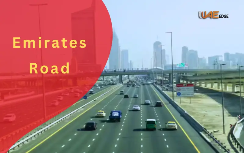
The United Arab Emirates (UAE) is also known internationally to have a well-developed infrastructure and the best road networks in the world. One of its most significant expressways is the Emirates Road (E611) – a long, well-planned highway, which links nearly all the major emirates in the nation.
The Emirates Road, which is approximately 110 kilometers long, is parallel to the Sheikh Mohammed bin Zayed Road (E311) and is an important alternative road to inter-emirate travel and logistics. It runs through the major cities of the country without stagnating in central Dubai and Sharjah, starting close to Al Falah in Abu Dhabi and continuing to Ras Al Khaimah.
Naming and Rebranding
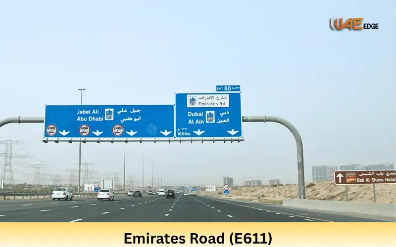
The expressway was originally called Dubai Bypass Road, but was renamed Emirates Road ( E611 ) in 2013. The rebranding made it equal to the unified road number system in the UAE -E signifies Emirates Route then its code. The change of names was also an indication of the national reach of the road since it was no longer serving Dubai only but linked six emirates. Such a common naming system made it easier for the residents, logistics operators and foreign visitors traveling the UAE road network.
Description of Routes and Large Connections
Route Overview
Emirates Road (E611) starts in the north of the desert hinterland in Abu Dhabi and runs northwards through the Al Falah area. The highway goes through Dubai’s southern industrial sector, through the inland parts of Sharjah and proceeds through Ajman, Umm Al Quwain, and finally, merges with E18 which goes through Ras Al Khaimah.
It has a total length of about 110 kilometers which guarantees a quick nonstop linkage between the southern and northern emirates. E611 is made as more of a long-distance and cargo vehicle to avoid inner-city routes and has a smoother and safer ride.
Key Sections by Emirate
Abu Dhabi Section
The section of Emirates Road is located to the south of Al Falah and Al Shamkha. It links well with E20 ( Sweihan Road ) and other local flights. It is a part that plays the crucial role of connecting the industrial outskirts of Abu Dhabi and the logistics areas of Dubai to allow the heavy vehicles to avoid the urban highways of the capital.
Nearby Developments:
- Al Falah City (residential)
- Sweihan Industrial Area
- Al Ajban road junctions
Dubai Section
E611 is flown in proximity to Dubai South, Jebel Ali and Dubai Industrial City (DIC) in Dubai. Some of the most vibrant commercial hubs in the UAE are located in this area. The road links with E77 (Jebel Ali 0 Lehbab Road) and E75, which provides transport between the Jebel Ali Port and the Al Maktoum International Airport with the other parts of the UAE.
Key Landmarks:
- Expo City Dubai
- Dubai Investment Park (DIP)
- Damac Hills 2 (Akoya Oxygen)
- Dubai Industrial City
Sharjah Section
In Sharjah, Emirates Road divides into E88 (Al Dhaid Road), which has direct access to Kalba and Khor Fakkan on the east coast. There is a number of industrial and warehousing centers in this section such as Al Sajaa industrial area and Sharjah national park.
Key Access Points:
- E88 (to East Coast)
- Al Dhaid & Al Batayeh exits
Ajman & Umm Al Quwain Section
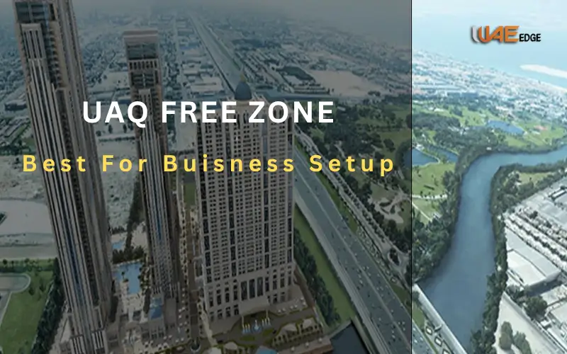
The E611 does not go through the city center of Ajman and offers a quick way to commuters and trucks. It is related directly to Ajman China Mall and goes to Umm Al Quwain, where it provides access to UAQ Free Zone and Marine Club.
Ras Al Khaimah Section
In RAK, the Emirates Road in Ras Al Khaimah Airport converges into E18 and connects to the road routes towards the Oman border. The scenery turns mountainous and picturesque to the north of the desert paths which are to the south.

🏙️ Major Cities Connected by Emirates Road
| City | Distance from Dubai | Travel Time (via E611) |
| Sharjah | 25 km | 20–25 minutes |
| Ajman | 35 km | 30 minutes |
| Umm Al Quwain | 60 km | 45 minutes |
| Ras Al Khaimah | 110 km | 1.5 hours |
| Abu Dhabi | 140 km | 2 hours |
| Al Dhaid (Sharjah) | 80 km | 1 hour |
Road Design and Infrastructure
Engineering Features
E611 is a six-lane (three in one direction) motorway that has reinforced asphalt layers that can handle heavy freight. The dual carriageway system, the wide medians and shoulders of the highway are very safe and easy to move around.
Other technical characteristics are:
- Solar-powered signboards and LED road lighting.
- Hardy Desert Storm drainage.
- Traffic monitoring smart road sensors.
- Residential adjacency area noise barriers.
Monitoring Systems and Safety Systems
Speed cameras and AI-based radar are fitted on the highway along major stretches. For different segments and car models, the speed limits are between 120 and 140 km/h. Emergency lay-bys are provided at every several kilometers, and the roadside call boxes provide a rapid connection to the highway patrol. The patrol cars of various emirates regularly watch over each other, which guarantees the promptness of the reaction to accidents or car failures.
Service Stations and Areas of Rest
The service stations on E611 are open at a distance of about 30 to 40 kilometers:
- Fuel services (ADNOC, ENOC, Emarat)
- Food courts and cafés
- Prayer rooms and restrooms
- Maintenance and parking of trucks.
Such rest areas will be critical to the long-distance drivers, particularly in the Sharjah and Umm Al Quwain desert portions where development access is very low.
Key Exits, Junctions, and Connectivity
Major Interchanges
| Exit | Connecting Road | Leads To | Landmarks |
| E77 | Sheikh Mohammed Bin Zayed Road | Jebel Ali, Dubai Industrial City | Expo City Dubai |
| E88 | Al Dhaid Road | Kalba, Khor Fakkan | Sharjah Desert Park |
| E55 | UAQ–RAK Road | Umm Al Quwain, Ras Al Khaimah | UAQ Corniche |
| E18 | Ras Al Khaimah Ring Road | RAK Airport, Oman border | RAK City |
These interchanges make Emirates Road one of the most connected highways in the UAE, providing alternate access points to major ports, airports, and free zones.
Connection with Other Highways
E611 is part of the national highway network in the UAE linking several strategic routes:
- E11 (Sheikh Zayed Road): Sea to city road.
- E311 (Sheikh Mohammed bin Zayed Road): Inner-city road.
- E44 (Dubai to Hatta road): Mountain and inland access.
- E88 and E55: East Coast and Northern Emirates connectivity.
This design enables effective detours in periods of congestion and provides redundancy of the transport network.
Not Economic or Logistical Significance
Trade and Transport
Emirates Road is a core in the logistics economy of the UAE. It facilitates:
- Cargo movement between Jebel Ali Port, RAK Port and Sharjah Free Zones.
- Redistribution among industrial centers and warehouses.
- International trade to Oman through the northern emirates.
E611 will reduce the number of heavy trucks in the city centers by diverting them off the urban routes which will ease the number of vehicles in the city centers, and congestion levels will be minimized.
Effects on Real Estate and Development
The presence of a high-speed road has made growth in the peripheral regions quicker. Dubai South and Akoya Oxygen as well as Al Falah City are residential places that have developed quickly because of direct access via the highway. The growth of industries is no exception, hundreds of factories and warehouses are now located in Al Sajaa Industrial Area (Sharjah) and Dubai Industrial City, and they are all interconnected by E611.
Contribution to UAE Vision 2030
The road is aligned to the long-term objectives of the UAE in the Vision 2030 by:
- Ensuring intelligent movement infrastructure.
- Promoting economic diversification through logistics and trade.
- Improving sustainable transport performance.
- Promoting the local union of Emirates.
Experience in Travel and Commuting
Driving Tips for Motorists
- Keep the lanes in check and abide by the speed limit (120140 km/h)
- Carry enough gasoline particularly in the long deserts.
- Unnecessary lane changes should be avoided: cameras keep an eye on unsafe driving.
- Take GPS or official map applications as a guide on how to exit.
- Having flat tire kits or overheating kits.
Facilities for Commuters
Most service areas offer:
- Petrol, food, rest and prayer facilities.
- Newer stations have EV charging stations.
- Maintenance check service centers for vehicles.
- Posts of the police and the emergency helpline.
Integration of Public Transport
Although mostly intended as elements of personal and commercial traffic, the UAE has incorporated bus routes that involve E611 interchanges:
- Stations Intercity buses Sharjah, Dubai and Ajman.
- Plans are made to have express freight corridors and bus-only lanes to carry workers in the future.
Traffic Management and Safety
Speed and Accident Control
Radar systems impose strict speed limits with heavy vehicles being compelled to use the right lanes only. UAE police departments have joint surveillance units that are used to detect compliance and provide immediate emergency support.
Emergency Support Systems
- 24-hour highway patrol
- Dispensing ambulance stations at key exits.
- Intelligent traffic monitoring with control centers.
- Vehicle breakdown roadside services.
Common Safety Tips
- Do not drive during early mornings when the fog is common.
- Low-visibility areas Use headlights.
- Have hazard triangles as well as reflective jackets in the car.
- Wear seatbelts always – camera numbers check offenders.
History and Other Destinations
Origins and Planning Phase
The beginning of the 21st century was the turning point in the urban growth of the UAE. Dubai and Sharjah, the busiest emirates, were experiencing increased traffic on E311 (Sheikh Mohammed bin Zayed Road) and E11 (Sheikh Zayed Road).
Its mission was to develop high-capacity and multi-lane highways in order to connect industrial, logistics and suburban regions in the Emirates, and ensure the inter-emirate connectivity.
Recreational and Tourist Attractions
- Expo City Dubai
- Sharjah Desert Park
- Ajman China Mall
- RAK Desert Safari zones
- UAQ Marine Club and beaches
Landmarks in the industrial and Logistics industry
- Dubai Industrial City
- Sharjah Al Sajaa Industrial Hub
- RAK Free Trade Zone
- UAQ Free Zone
Residential Communities
- Al Falah City, Abu Dhabi
- Dubai South Residential Area
- Akoya Oxygen (Damac Hills 2)
- Sharjah Modern Industrial City, Emirates
These neighborhoods enjoy direct advantages of being close to E611 by providing them with cheap accommodation with great access to inter-emirates.
🏕️ Tourist Spots Accessible via E611
| Tourist Destination | Emirate | Distance from E611 | Attraction Type |
| Dubai Outlet Mall | Dubai | 2 km | Shopping |
| Sharjah Desert Park | Sharjah | 5 km | Nature & Wildlife |
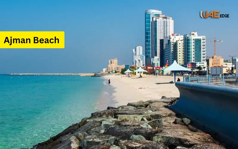
| Ajman Beach | Ajman | 7 km | Beach Leisure |
| Dreamland Aqua Park | Umm Al Quwain | 3 km | Family Water Park |
| RAK Jebel Jais | Ras Al Khaimah | 30 km | Mountain Adventure |
| Al Dhaid Farms | Sharjah | 8 km | Eco & Farm Tourism |
Plans and Future Development and Expansion
Smart Infrastructure Projects
The E611 is still being equipped with smart road technologies in the Ministry of Energy and Infrastructure of the UAE:
- Self-driving traffic control systems.
- Solar-powered lighting
- Real-time sensors of vehicles.
These technologies increase safety and minimise maintenance expenses.
Future Connection Improvements
New exchanges to be developed in residential development in Dubai South. Enhancement of the road between Sharjah UAE. Connection with Fujairah and Al Ain flights to enhance internal connectivity.
Vision of Sustainable Mobility
- EV charging at significant ADNOC and ENOC stations.
- Green materials of fresh pavements.
- Greener landscaping with desert-resistant plants.
- Less CO2 because the heavy traffic will be diverted to the populated areas.
Comparison with Other Major UAE Highways
E611 vs. E311 (Sheikh Mohammed bin Zayed Road)
| Feature | E611 (Emirates Road) | E311 (SMBZ Road) |
| Purpose | Long-distance & cargo route | Urban commuter highway |
| Congestion Level | Low | High |
| Speed Limit | 120–140 km/h | 100–120 km/h |
| Toll Gates | None | Some (Salik) |
| Traffic Type | Trucks & intercity | Mixed (residential & commercial) |
E611 vs. E11 (Sheikh Zayed Road)
E11 transfers in cities and the seashores, and thus it is scenic though slower over long distances.
E611, however, operates inland, speedier, more direct and made to transport and logistics between emirates.
Summary and Conclusion
The Emirates Road (E611) is one of the examples of UAE strategic planning and dedication to excellence in infrastructure development.
It has turned out to be a vital artery of trade, transportation, and daily commuting because it provides a high-speed, secure, and efficient link between six emirates.
E611 is not only a highway but it is also:
- Smart infrastructure innovation.
- Inter-emirate mobility efficiency.
- Sustainability in terms of less congestion.
The significance of Emirates Road will only increase as new communities and logistics zones continue to emerge along the road, establishing it as one of the most important highways in the UAE in the future.
FAQs About Emirates Road (E611)
What is the overall distance of Emirates Road?
Emirates Road is a 110-kilometer road that connects Abu Dhabi to the south and Ras Al Khaimah to the north.
Which are the emirates through which E611 passes?
The highway goes through Abu Dhabi, Dubai, Sharjah, Ajman, Umm Al Quwain and Ras Al Khaimah, connecting all the emirates in the north and making it an efficient transport route.
Does E611 include toll gates?
No, there are no Emirates Road toll (Salik) gates. Other Dubai roads like Sheikh Zayed Road or Al Khail Road, however, could have Salik tolls.
Do we use E611 with trucks and heavy vehicles?
Yes, E611 has been specifically created to accommodate cargo and freight shipment, which is why the road is a favorite of heavy trucks and business traffic trying to avoid the congested city traffic.
What is the mean speed limit on Emirates Road?
The mean speed is 120km/h to 140km/h depending on the section of the road.
Who is to take care of Emirates Road?
The UAE Ministry of Energy and Infrastructure upkeep and manages the road, making sure that it is safe, in addition to being smooth and constantly developed.